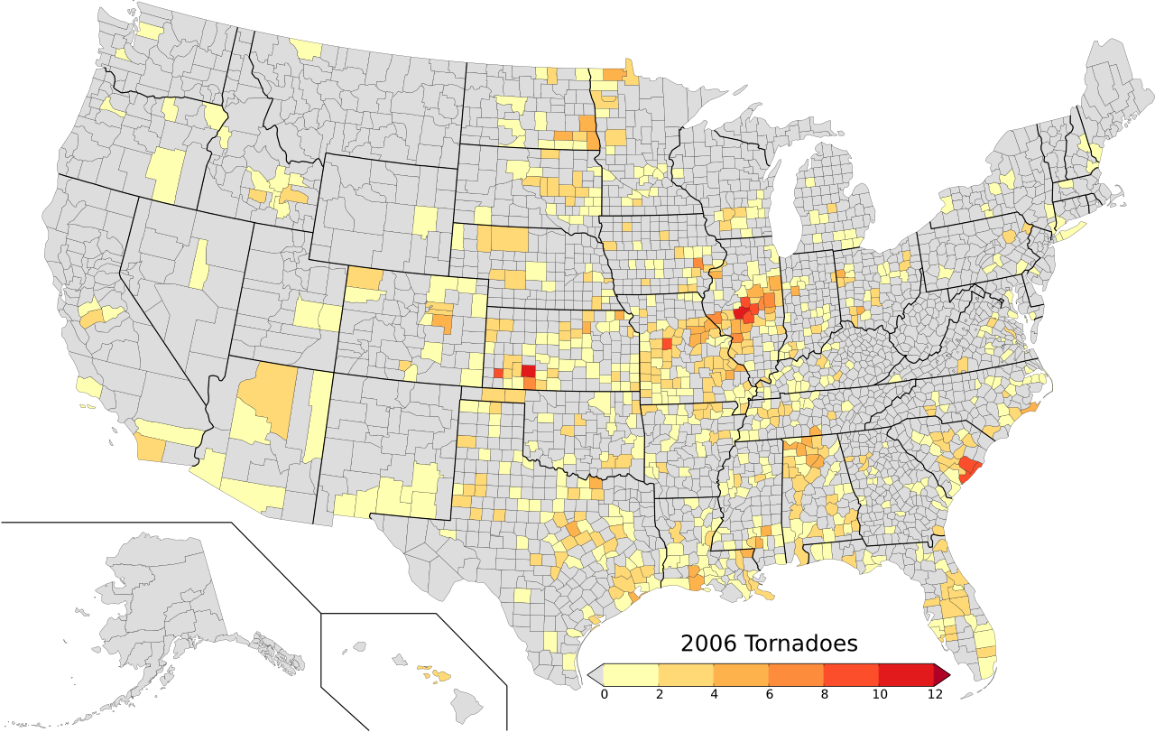
As many already know, the southern plains is in the midst of a fairly pronounced drought. The drought reminds me of the drought we experienced in Norman during 2005-2006. During the drought, the rain stopped in late summer of 2005 and remained that way through November of 2006, when a very intense cyclone helped to alter the prevailing storm track.
As we head into the spring storm season, I’ve been getting asked more and more frequently how the lack of precipitation in the southern plains will affect storm season. The answer to this question is highly complex, and poorly understood at this time. However, I’ll offer one possible outcome.
The lack of southern plains precipitation, and more importantly, the dry soil, might allow the dryline to mix eastward faster than if the soil held more moisture. This, coupled with warm air aloft being advected over the southern plains from the higher elevations of New Mexico (which has also been extremely hot and dry of late), will help suppress thunderstorm and tornado development across much of western Oklahoma and the Texas Panhandle.
This is what happened in 2006, and you can see based on the graphic below, most of the tornadoes were to the north and east of western OK.
